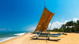
Start & Negombo Beach
Relax at the beautiful Negombo Beach — golden sands and ocean views.
View on MapRoute: Haputale >> Ella >> Belihul Oya >> Colombo | 3 Day Adventure Route
Relax at the beautiful Negombo Beach — golden sands and ocean views.
View on Map
Drive inland from the coast to the scenic town of Kuruwita to visit **Bopath Falls**, named for its shape resembling a sacred fig (Bo) tree leaf.
The waterfall is a popular spot for swimming and enjoying the beautiful, natural surroundings.
Distance to Bopath Falls: ~104 km | Time: 2 hours 44 minutes
View on Map
This picturesque, tranquil village acts as the main base for adventure tourism in the area. It is named after the **Belihul Oya** (river), which is a key tributary of the Walawe River.
It's the ideal spot for a relaxing overnight stay after a long drive.
Primary Activities: River bathing, trekking, camping, kayaking, and access to nearby waterfalls.
View on Map
A beautiful, secluded waterfall known for its unique appearance, which resembles a **Pahan Thuda** or **"Lamp Wick"** when the water cascades down. It flows into a natural pool at the base of a small, hidden cave.
Reaching the falls requires a relatively **easy 10-15 minute hike** down from the main road, but the path can be slippery.
Key Advice: Exercise extreme caution near the pool's edges, as the rocks are wet and slick.
View on Map
Located near the Kinchigune area, Surathali Ella is a beautiful, multi-tiered waterfall known for its serene and less-crowded environment compared to more famous cascades.
It is generally considered a safer spot for bathing, but visitors should still adhere to water safety rules and check water levels with locals.
Primary Activities: Photography, quiet contemplation, and river dips in safe areas.
View on Map
Head further inland and into the deep hill country to reach **Bambarakanda Falls**, the tallest waterfall in Sri Lanka, which plunges 263 meters. This location offers a rewarding experience, often involving a short hike to appreciate the sheer size of the waterfall.
Distance to Bambarakanda Falls: 11.6 km | Time: 30 minutes
View on Map
The **Devil's Staircase** is one of the most famous trekking and 4x4 off-road adventures in Sri Lanka. It’s a steep, winding path between Bambarakanda and Ohiya.
⚠️ **Important Note:** The direct route is only suitable for **extreme trekking** or a **high-clearance 4x4 vehicle** and should not be attempted in a normal car.
The time and distance below reflect the required drive around the mountains to reach the upper (Ohiya) end of the trail.
Distance (Driving Loop): 54 km | Time: 2 hours 7 minutes
View Driving Route on Map
This journey takes you into the stunning mountain ranges around Haputale. The **Pitaratmalie Tea Factory** is known for its high-quality tea production and beautiful setting in the hills.
Like other factories in the region, you can witness the traditional methods of tea processing and enjoy fresh, authentic Ceylon tea.
Distance: 39.3 km | Time: 1 hour 39 minutes
View on Map
Follow the tea-lined road up to **Lipton's Seat**, the viewpoint where the famed tea baron Sir Thomas Lipton surveyed his vast tea empire.
This spot is renowned for its striking, panoramic views that stretch across the Uva, Central, and Sabaragamuwa provinces. It also has a small cafe.
Travel Tip: For the best visibility, plan to arrive early in the morning, before 10:00 AM, as the views often get covered by mist later in the day.
Distance: 7.7 km | Time: 31 minutes
View on Map
Journey from the Haputale region to **Ella**, one of Sri Lanka's most famous destinations. **Little Adam's Peak** is a short, relatively easy hike that offers stunning views of Ella Rock, the surrounding mountains, and the valley below.
The trailhead is easily accessible from Ella town, making it a perfect afternoon activity.
Distance: 38.4 km | Time: 1 hour 35 minutes
View on Map
Walk from the base of Little Adam's Peak directly to the iconic **Nine Arch Bridge** (also known as the Bridge in the Sky). This massive viaduct is one of the best examples of colonial-era railway construction in Sri Lanka and is surrounded by dense jungle and tea plantations.
The **walk itself is part of the experience**, leading you along the railway track (take caution) or a scenic jungle path.
Travel Tip: Check the current train schedule to ensure you are there when a train passes—it's the best photo opportunity!
Distance (Walking): 1.7 km | Time: 23 minutes
View Walking Route on Map
The journey from the iconic railway bridge takes you to **Ravana Falls**, a massive, tiered waterfall visible right from the main roadside. It is a stunning natural attraction, especially during the monsoon season when the water volume is high.
The falls are linked to the legendary King Ravana from the Hindu epic *Ramayana*, who is said to have hidden a captured princess in a cave behind the falls (Ravana's Cave is nearby).
Distance: 11 km | Time: 31 minutes
View on Map
Your journey ends at the **Demodara Loop** (often referred to as the Double Bridge or Spiral Loop). This is an extraordinary feat of railway engineering where the track circles a hilltop and passes directly under itself through a tunnel, allowing the train to gain elevation in a tight space.
The directions will take you to the vicinity of the **Demodara Iron Bridge**, where you can find viewpoints overlooking the loop.
Distance: 12.9 km | Time: 29 minutes
View on Map
This journey transitions from the lush green hills of Ella to the dry scrublands and savannahs of the South, leading you to **Yala National Park**. Yala is famous for having one of the world's highest densities of leopards, as well as a large population of Sri Lankan elephants, crocodiles, and various bird species.
The **Yala National Park** destination refers to the general area where safaris begin. Be sure to book a jeep safari to experience the park's wildlife.
Distance: 66.5 km | Time: 1 hour, 36 minutes
View on Map
This is a long but direct drive that primarily utilizes the Southern Expressway (E01) for a fast, modern connection back to **Colombo**. This trip takes you from the southeast coast up to the West Coast, where you'll re-enter the bustle of the capital.
Distance: 263 km | Time: 3 hours, 55 minutes
View on Map